
Ghost town · Columbia, Pennsylvania, United States
Centralia (Pennsylvania, USA)
Updated November 20265 sourcesHow to visit
- 2 archive documents
A Pennsylvania coal town emptied by a mine fire burning under it since 1962. No ghosts, but a priest's curse legend and the real-life model for Silent Hill.
The story
Centralia lies in the anthracite country of northeastern Pennsylvania, in Columbia County, entirely enclosed by Conyngham Township. Its land changed hands long before there was a town. Native American nations sold a large part of the region, the valley included, to colonial agents in 1749 for £500, and settlers surveyed it in 1770 while cutting the Reading Road toward Fort Augusta, the route later followed by Route 61. Robert Morris, the Revolutionary financier and signer of the Declaration of Independence, bought a third of the valley in 1793; after his bankruptcy the land passed to the Bank of the United States and then to Stephen Girard, the French-born Philadelphia merchant and banker, who knew there was coal underneath.
The first settlement took its name, Bull's Head, from a tavern Johnathan Faust opened in 1832. In 1842 the Locust Mountain Coal and Iron Company bought the land, and its mining engineer, Alexander Rae, laid out streets and building lots for a village he called Centreville. Since neighboring Schuylkill County already had a post office called Centreville, the name was changed to Centralia in 1865, and the borough was incorporated in 1866. Coal only became truly profitable once the Mine Run Railroad reached the valley in 1854.
The mining boom brought labor violence. In the 1860s Centralia was a stronghold of the Molly Maguires, a secret network among Irish mineworkers tied to efforts to win better pay and conditions, and the decade saw murders and arson. Many of the group's leaders were hanged in 1877. Centralia then settled into the life of a small coal town, and about 1,000 people still lived there in 1980.
Why it was abandoned
The fire began in May 1962; the borough's memorial history site gives May 27. The most widely cited explanation is that the town's landfill, which occupied a worked-out strip-mine pit, was set alight to clean it up before Memorial Day, and that the flames found their way into abandoned mine tunnels through an opening that had never been sealed. Other explanations exist: journalist Joan Quigley has pointed to hot ash dumped in the pit, and some link the blaze to an older fire at the Bast Colliery in 1932. Whatever the spark, the seams beneath the town caught, and every attempt to stop the fire failed.
For years the fire was a slow, invisible threat: steam and smoke rising from cracks and vents, toxic gases, ground that sank. It became a national story on February 14, 1981, when a 12-year-old boy fell into a sinkhole that opened in his grandmother's yard, a hole roughly 150 feet deep venting steam laden with lethal levels of carbon monoxide. His cousin pulled him out.
Congress then set aside about $42 million for relocation (1983 according to Wikipedia, 1984 according to the town's memorial site). Between 1985 and 1991, 545 properties were bought and most families moved away. In 1992 Governor Bob Casey invoked eminent domain, and the Commonwealth claimed and condemned all real estate in the borough. The Postal Service retired the ZIP code, 17927, in 2002. A small group of holdouts fought on, and in a settlement (October 2013 with seven residents per Wikipedia; 2012 with five property owners per the memorial site) the last holdouts won the right to stay in their homes for life, after which the state takes the properties. Five people remained in 2020, making Centralia the least-populated municipality in Pennsylvania.
The legend
Centralia earns the label "ghost town" from its empty streets, not from any ghosts. No reliable source we read records ghost sightings, named spirits or paranormal investigations here, and we found no ghost-hunting TV show that filmed it. Its supernatural reputation rests on one local legend and on popular culture.
The legend concerns Father Daniel Ignatius McDermott, remembered as the first Roman Catholic priest to live in Centralia. Locals tell that three Molly Maguires assaulted him in 1869 and that he cursed the land in return, prophesying that St. Ignatius Church would someday stand alone where the town had been. The story was recorded by journalist David DeKok in his 2009 book on the fire, Fire Underground. It is folklore, told after the fact, and it gained its power once the fire had emptied the town. According to Wikipedia, the church that survives on the hill is the Ukrainian Catholic church of the Assumption, on solid rock; St. Ignatius, the church named in the prophecy, is listed by the memorial site as 1869-1995, so the tale's neat ending does not hold. Another local legend holds that descendants of the Molly Maguires were still living in town until the 1980s.
Popular culture did the rest. Screenwriter Roger Avary studied Centralia while writing the 2006 film Silent Hill, which gave the town its foggy, ash-filled image for a generation of viewers. The original Silent Hill video game, however, was not based on any real place, as its artist Masahiro Ito stated in 2019. Writers have also used Centralia as a template for hellish or deserted towns, notably Dean Koontz in Strange Highways and David Wellington in Vampire Zero. The real hazards here are physical, not spectral: heat, gas and unstable ground.
What remains today
Most houses have been demolished, leaving a grid of streets with long empty stretches and only a few buildings. Photographs show the municipal building still standing in 2019, benches near a small park in the center, and a cemetery, along with a Buck Vein coal outcrop southwest of town. An aerial picture from August 1971 is a useful comparison: it shows a complete town of streets and houses.
The best-known landmark of the 2000s and 2010s, the "Graffiti Highway," a closed stretch of the old Route 61 covered in graffiti, no longer exists in that form. Its owners buried it under mounds of dirt in April 2020.
Visiting
There are no ghost tours and no visitor facilities. The condemned land belongs to the state, and the handful of remaining homes are private: respect the residents, do not enter any property and do not photograph people or houses at close range. Do not take anything from the cemetery.
The fire is still burning underground. Stay on public roads, keep well away from fenced or signed areas and from anything venting steam or smoke, and keep children and pets close, since the ground can collapse and the gases can be deadly. For background, the memorial history site centraliapa.com, created in 1999, and the books by David DeKok and Joan Quigley tell the story in far more depth than a drive-through ever can.
Photographs


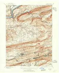
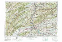
Old maps
Where it is
The circle shows the general area only. Open on the full map
Sources
- Wikimedia Commons category : Centralia, Pennsylvania — Wikimedia Commons
- USGS 1:250000-scale Quadrangle for Harrisburg, PA 1957 — U.S. Geological Survey, 1957 · Public domain (USGS)
- USGS 1:62500-scale Quadrangle for Catawissa, PA 1889 — U.S. Geological Survey, 1889 · Public domain (USGS)
- Official website
- Wikipedia article — Wikipedia · CC BY-SA 4.0
Text written by AI from the sources above and checked by a separate AI fact-check (how we work). Images: credits and licenses under each picture.
Spotted a mistake? Report an error